Slaugham
 An Introduction to the village...
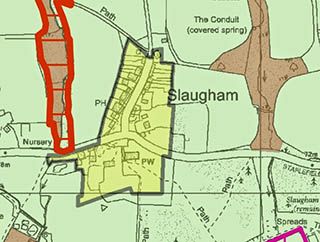
Slaugham (pronounced ‘slafam’) is the smallest village in the parish and is located around the junction of Staplefield Road and Park Road, approximately half a mile west of the A23.
Originally one of the ‘iron villages’ of the Sussex Weald, it is situated on a ridge between two small river valleys running north to south. It is surrounded by attractive countryside comprising farmland and woodland.
Despite the small size of the village, Slaugham (designated a conservation area) includes a variety of building styles and ages including a number of buildings which are timber framed, red brick with half tile hung and tiled roofs and others which are constructed with sandstone blocks occasionally with stone roofs. To the southern end of the village is the parish church of St Mary, which forms an attractive focal point. There is a Norman church with a 13th century clock tower and a Victorian clock. Lord Nelson's sister is buried here. The southern side of the churchyard provides views towards the ruins of Slaugham Place, an Elizabethan mansion, which is a scheduled ancient monument.
The village has just the one main street — Park Road but known as ‘The Street’ — running from The Green by the Church to the parkland of Slaugham Park, where the main population resides. The Street is lined with many listed houses. The village tap — no longer working — is quite quaint and now carries the village notice board. There is also another unusual feature, a white telephone box, possibly the only one in the county and a Grade II Listed Building. The Street also has two unique lampposts, which have the royal crown on top.
There are two large lakes nearby, Slaugham Mill Pond, with mentions of a mill dating from 1339, and the Furnace Pond, the name of which derives from the former iron works in the area and is surrounded by Slaugham Common. The nearby ruins at Slaugham Place are a scheduled ancient monument and a registered park and garden. Church Covert lies to the south of the churchyard and is managed by the Woodland Trust.
There is an active community spirit fostered by the Slaugham Society and the
Chequers Inn is popular with locals and visitors. The village attracts cyclists, walkers and other visitors. At the north of The Street there is a children’s playground, which is owned by the parish council.
Roads & TransportIn Slaugham, the effects of the recent closure of the junction of the A23 to the east of Slaugham village are yet to be established as improvement work was only completed in autumn 2014. Parking and associated congestion can be a problem both in The Street and at the crossroads adjacent to the church.
Economic CharacteristicsThere are a few small businesses in Slaugham village and there is a single public house restauaunt, The Chequers, residents in the village view this as important socially and economically, as gathering places and mainstays of village life.